Resources

 The project will investigate the exposure and sensitivity of Wet Tropics plants and animals to extreme climatic events, such as heat waves, fires, flooding rain and cyclones.
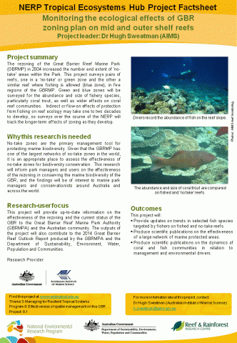 The rezoning of the Great Barrier Reef Marine Park (GBRMP) in 2004 increased the number and extent of ‘no-take’ areas within the Park. This project surveys pairs of reefs, one in a ‘no-take’ or green zone and the other a similar reef where fishing is allowed (blue zone), in five regions of the GBRMP. Green and blue zones will be surveyed for the abundance and size of fishery species, particularly coral trout, as well as wider effects on coral reef communities. Indirect or flow-on effects of protection from fishing on reef ecology may take one to two decades to develop, so surveys over the course of the NERP will track the longer-term effects of zoning as they develop.
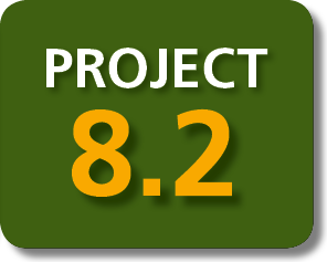
 This project has provided convincing evidence that no-take marine reserves have significantly improved the status of fished species in the Great Barrier Reef Marine Park (GBRMP). The project has also established the basis for assessing the role of no-take marine reserve networks in protecting biodiversity, sustaining ecosystem goods and services and providing a buffer against natural disturbances, such as extreme weather events and the cumulative impacts of climate change.

 Previous research has shown compelling evidence for green zones as an effective conservation and fisheries management tool. However, the scale over which reserves benefit fisheries by providing stock and the degree to which they contribute to maintaining fish populations in the long term needs to be evaluated.

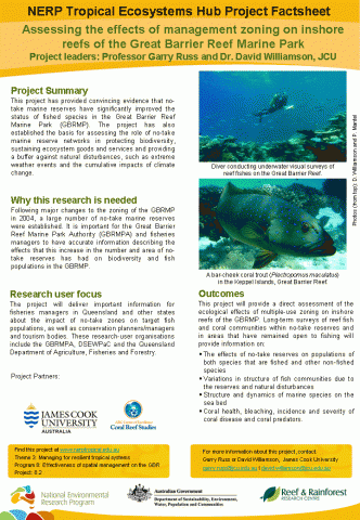
 To support management of the Great Barrier Reef Marine Park, coral reef managers need decision support tools that can integrate physical and biological information at a variety of spatial and temporal scales. In this project we will construct vulnerability maps for the Great Barrier Reef (GBR) that combines our knowledge of ocean warming, hydrodynamics, ocean chemistry with ecological responses of coral reef organisms.
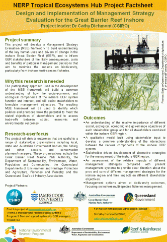 This project will develop a Management Strategy Evaluation (MSE) framework to build understanding of the key human uses and drivers of change in the inshore Great Barrier Reef (GBR), and to inform GBR stakeholders of the likely consequences, costs and benefits of particular management decisions that aim to minimise the impacts on biodiversity, particularly from inshore multi-species fisheries.

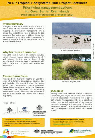 Managers of the Great Barrier Reef’s (GBR) 900 islands face difficult decisions when it comes to investing in conservation management. Where should they invest limited funds to achieve the best outcomes? This project aims to address this problem by developing a decision making framework for investing cost-effectively in management actions across the GBR islands.
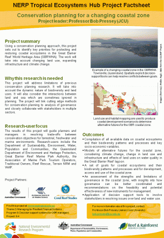 Using a conservation planning approach, this project sets out to identify key priorities for protecting and restoring coastal ecosystems in the Great Barrier Reef World Heritage Area (GBRWHA). The work will take into account changing land use, expanding infrastructure and climate change.

