Resources
Gladstone Observer
14 January 2014
THE impact of catchment pollutants on the Great Barrier Reef is nothing compared to the devastation caused by a reduction in salinity following major floods, according to CQUniversity researcher Dr Alison Jones, who says major floods are "nature's ground zero".
Writing in the PLOS ONE journal this week, Dr Jones discusses the period of December 2010 when the highest recorded Queensland rainfall associated with Tropical Cyclone Tasha caused flooding of the Fitzroy River in central Queensland. Read more

 Tropical Ecosystems Hub researchers have drawn chilling conclusions for the future of specialist rainforest vertebrate species in the Wet Tropics region in a changing climate.
In its fifth Assessment Report, the Intergovernmental Panel on Climate Change (IPCC AR5) adopted four Representative Concentration Pathways (RCPs) for estimating the trajectory of greenhouse gas concentration in the atmosphere. The four pathways, RCP 2.6, RCP 4.5, RCP 6 and RCP 8.5, are effectively measures of the extent to which the Earth’s energy budget will be out of balance in the year 2100 relative to pre-industrial values.
The team from Project 3.1 Rainforest Biodiversity have concluded that, under a low emission scenario (RCP 4.5), about 10% of endemic rainforest vertebrates in the Wet Tropics are expected to be critically endangered by 2085. However, under a high emission scenario (RCP 8.5), similar to what we are currently tracking, nearly 60% of these species will be critically endangered.
Whilst the big challenge is to reduce global greenhouse gas emissions, the challenge for local land use managers and planners is to determine which areas provide refuge for species in a changing environment to maximise conservation of biodiversity.
Identifying areas with high species richness, species turnover or species endemism is an important first step in determining likely refugia both now and in the future. By using conservation prioritisation software, the team ensure that the areas of highest priority incorporate complementarity across both species and sites.
The project team’s analysis included 202 species across taxonomic groupings of birds, reptiles, amphibians and mammals from the Centre for Tropical Biodiversity and Climate Change long term monitoring database. The team assessed climate change impacts on individual species and biodiversity as a whole against the RCP emission scenarios for decadal time steps from present to 2085.
The modelling produced a suite of predictive metrics for use in understanding future impacts on species distributions and the ecology of the animals of the Wet Tropics. The project team focused on two variables from the models, “change in abundance” and level of future “habitat fragmentation”.
The results largely paint a grim picture for the survival of the endemic vertebrates of the rainforests of North Queensland if global greenhouse gas emissions continue to rise rapidly.
The results indicate that, with the “business-as-usual” worst-case scenario (RCP 8.5), great losses in species are predicted to occur by 2085. Coupled with these predicted losses in vertebrate populations in the future, results indicate that populations will be highly fragmented.
Mitigating greenhouse gas emissions and increasing carbon sequestration on a global scale is necessary to avert the worst of the scenarios modelled under IPCC AR5. However, the results of the current research emphasise the importance of identifying local, critical climate change refugia early and maintaining or enhancing connectivity between sites in anticipation of future climate scenarios.
To this end, the Queensland government is now using the methodology developed through this research to identify climate change refugia in the Wet Tropics region with the intention of purchasing land where necessary.

ABC News
14 October 2013
Queensland Environment Minister Andrew Powell says he is happy to consider legislative changes to help Cape York Indigenous people manage turtles and dugongs.
A new management plan with input from about 30 clans was launched on the weekend. Read more


Managers of the Great Barrier Reef’s 900 islands face difficult decisions when it comes to investing in conservation management. So where should they invest limited resources to achieve the best outcomes for management problems?
These conservation decisions must be made in the face of spatially heterogeneous and dynamic threats, including invasive plants and animals and inappropriate fire regimes, and within a constrained budget. NERP Tropical Ecosystems Hub researchers from James Cook University are assembling a decision-making framework for such a purpose.
Project 9.3 works closely with GBRMPA and the Queensland Government to develop a cost-effective approach to prioritising management actions across GBR islands. More specifically, the project’s goal is to maximize conservation outcomes defined by specific objectives for diverse natural features, including native plant and animal species, vegetation assemblages and breeding aggregations.
A decision-support tool with GIS capability will help managers to identify management priorities within and between islands. The project will deliver results that are useful to a range of stakeholder organisations, including state and Australian government bodies, the tourism sector, and conservation planners and managers.

The project covers both Queensland and Commonwealth Islands in the southern sector of the GBR from Mackay to Bundaberg. This region was chosen based on the national and international significance of these islands in relation to vulnerable and endangered species, tourism value, and the likely threats presented by expanding industrial development.
For the initial development of the decision-support tool, 13 islands have been chosen as a representative sample of the southern GBR islands. These islands differ in size, geomorphology, species assemblages, regional ecosystems, threats and commercial and recreational uses. As a result, the selected islands encapsulate the varied challenges for management.
After the initial number of islands has been enlarged, the main project outputs will be:
- A compilation of all available data, including quantified expert judgements on islands to set parameters for key variables to be used in the management prioritization.
- A novel, cost-effective, transparent, and accountable approach to prioritizing management actions for multiple objectives across islands, designed and understood by GBR managers.
- An interactive, spatially explicit decision-support tool for day-to-day use that will allow managers to identify action-specific management priorities within and between islands.
Amelia Wenger, JCU
For more information, contact Amelia Wenger at: amelia.wenger@my.jcu.edu.au
Project 9.3: Prioritising management actions for Great Barrier Reef islands
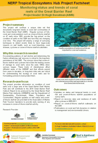 This project will continue a unique data set that documents long-term trends in coral reef communities of the Great Barrier Reef (GBR). Regular surveys of fish, coral and coral predators such as crown-of-thorns starfish on 47 reefs since 1992, provide the ‘big picture’ on the condition of reefs on the GBR and how they are changing over time. This project will employ a range of surveying techniques to detect events likely to have large-scale impacts on reef health, such as coral bleaching, coral disease, cyclones or crown-of-thorns starfish outbreaks.


Miller, I., Cheal, A.J., Emslie, M.J., Logan, M., Sweatman, H. (2012) Ongoing effects of no-take marine reserves on commercially exploited coral trout populations on the Great Barrier Reef. Marine Environmental Research. 79, 167-170 [doi:10.1016/j.marenvres.2012.05.008].
* Funded by AIMS
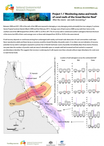 After the storm - are reefs recovering?
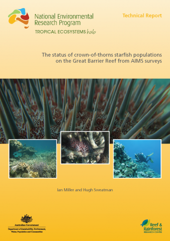
Miller, I., Sweatman, H. (2013) The status of crown-of-thorns starfish populations on the Great Barrier Reef from AIMS surveys.
© Australian Institute of Marine Science (AIMS)
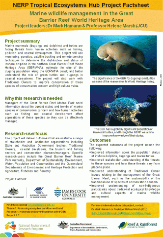 Marine mammals (dugongs and dolphins) and turtles are facing threats from human activities such as fishing, pollution and coastal development. This project will use monitoring, genetics, satellite tracking and remote sensing techniques to determine the distribution and status of inshore dolphins in the northern Great Barrier Reef World Heritage Area (GBRWHA); estimate the size of the dugong population along the GBRWHA coast; and better understand the role of green turtles and dugongs in coastal ecosystems. The project will also work with Traditional Owners to improve conservation of these species of conservation concern and high cultural value.
Marine Ecology Progress Series
Shimada, T., Jones, R., Limpus, C., Hamann, M. (2012) Improving data retention and home range estimates by data-driven screening. Marine Ecology Progress Series. 457, 171-180 [doi:10.3354/meps09747].
Pages
Latest News
- Laws protecting the Great Barrier Reef to be introduced next week, Queensland Premier says - Thu 28th May 2015
- Let’s get serious about protecting wildlife in a warming world - Thu 28th May 2015
- We’ve only monitored a fraction of the Barrier Reef’s species - Thu 28th May 2015
- Great Barrier Reef: warmer waters helping coral-eating starfish thrive - Fri 13th Feb 2015
- You are what you eat—if you're a coral reef fish - Wed 17th Dec 2014

Current search
Search found 254 items
- [all items]